Description:
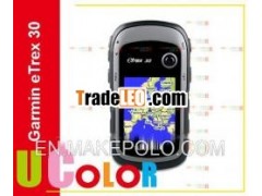
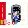
Original New GARMIN eTrex 30 Handheld GPS Receiver NavigatoreTrex30 010-00970-20
Overview:- Worldwidebasemap
- 2.2" 65K color,sunlight-readable display
- 3-axis compass andbarometric altimeter
- Wireless capabilityto share waypoints, routes and geocaches with other similardevices
- GPS and GLonASSsatellites for faster positioning
Specification: | Physical& Performance: | | Unit dimensions,WxHxD | 2.1" x 4.0" x 1.3"(5.4 x 10.3 x 3.3 cm) | | Display size,WxH | 1.4" x 1.7" (3.5 x4.4 cm); 2.2" diag (5.6 cm) | | Display resolution,WxH | 176 x 220pixels | | Displaytype | transflective, 65-Kcolour TFT | | Weight | 5 oz (141.7 g) withbatteries | | Battery | 2 AA batteries (notincluded); NiMH or Lithium recommended | | Balterylife | 25 hours | | Waterresistant | Yes(IPX7) | | High-sensitivityreceiver | Yes | | Interface | USB | | Maps& Memory: | | basemap | Yes | | Ability to addmaps | Yes | | Built-inmemory | 1.7 GB | | Accepts datacards | microSD card (notincluded) | | Waypoints/ favorites/locations | 2000 | | Routes | 200 | | Track log | 10000 points. 200saved tracks | | Features& Benefits: | | Automatic routing(turn by turn routing on roads) | Yes (with optionalmapping for detailed roads) | | Electroniccompass | Yes (tlit-compensated3-axis) | | Barometricaltimeter | Yes | | Geocaching-friendly | Yes(Paperless) | | Custom mapscompatible | Yes | | Photo navigation(navigate to geotagged photos) | Yes | | Sun and mooninformation | Yes | | Areacalculation | Yes | | Custom POIs (abilityto add additional points of interest) | Yes | | Unit-to-unit transfer(shares data wirelessly with similar units) | Yes | | Pictureviewer | Yes | | Garmin Connect™compatible (online community where you analyze, categorize andshare data) | Yes | | Additional | This USB mass storagedevice is compatible with Windows® XP or newer and Mac® OS X 10.4or later. |
|
Original New GARMIN eTrex 30 Handheld GPS Receiver Navigator eTrex30 010-00970-20


 Sell
Sell